Trail Other activity Autonomous City of Buenos Aires - Palermo - Photo
 ataollah
ataollah

User

© OpenStreetMap contributors
Length
Length
4.6 km
Max alt
Max alt
50 m
Uphill gradient
Uphill gradient
55 m
Km-Effort
Km-Effort  
5.2 km
Min alt
Min alt
15 m
Downhill gradient
Downhill gradient
29 m
Boucle
Boucle
No
Creation date :
2014-12-11 00:00:00.0
Updated on :
2014-12-11 00:00:00.0

(0 Reviews)

Other activity
Other activity
10m
Difficulty : Very easy

Scan this QR Code to open this trail in the SityTrail application

FREE GPS app for hiking

Logo SityTrail SityTrail

IGN / Geographical institutes

Download SityTrail from the App Store Download SityTrail from Google Play

Logo SityTrail SityTrail World

The world is yours!

Download SityTrail from the App Store Download SityTrail from Google Play Download SityTrail on Huawei AppGallery

About

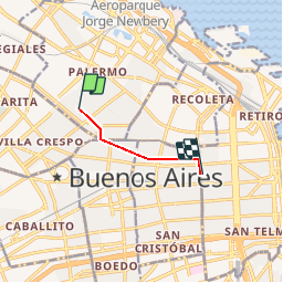
Trail Other activity of 4.6 km to be discovered at Autonomous City of Buenos Aires, Unknown, Autonomous City of Buenos Aires. This trail is proposed by ataollah.

Elevation profile

Positioning

Country:
Argentina
Region :
Autonomous City of Buenos Aires
Department/Province :
Unknown
Municipality :
Autonomous City of Buenos Aires
Location:
Palermo
Start:(UTM)
368829 ; 6171486 (21H) S.

Trails nearby

Trail Other activity Autonomous City of Buenos Aires - Laguna Gaviotas - Photo
Other activity
ataollah

Other activity

Very easy
Autonomous City of Buenos Aires, Autonomous City of Buenos Aires, Unknown, Argentina
5.8 km | 6.7 km-effort
2h 0min
No


Close
My subscriptions